

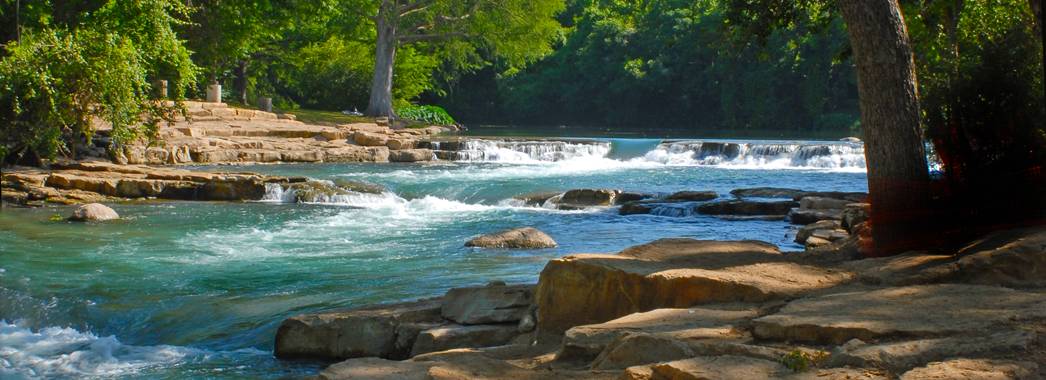
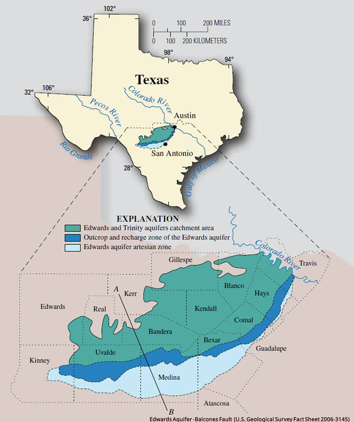
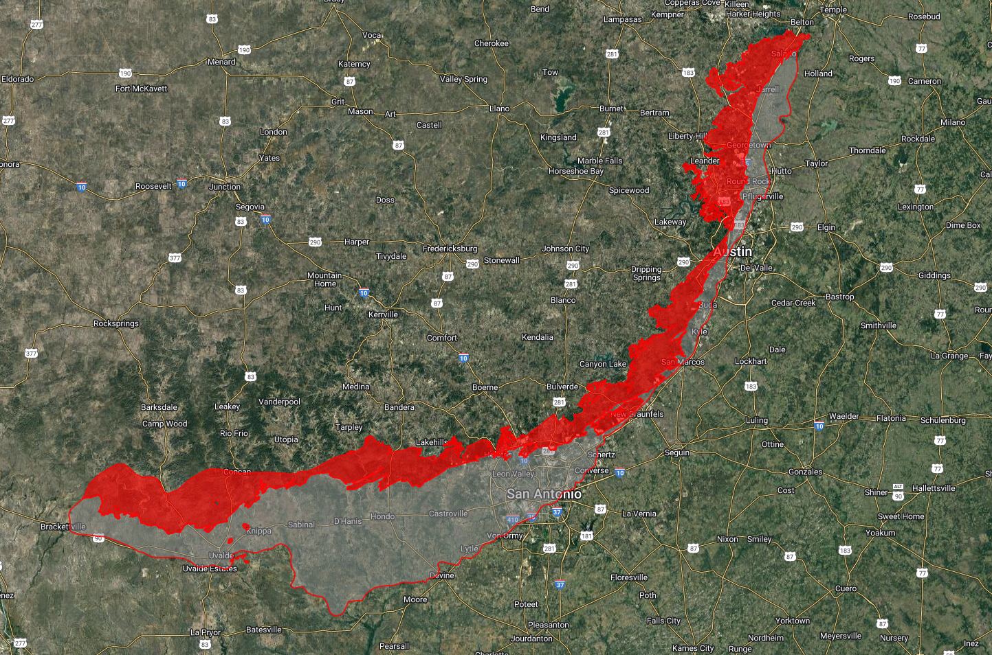
The Edwards Aquifer is a highly productive karst limestone aquifer in south‑central Texas that supplies drinking water to around 1.7–2 million people and feeds major springs like Comal and San Marcos Springs. It is critical for cities such as San Antonio and the Austin–San Antonio corridor, as well as for regional rivers, agriculture, industry, and several endangered species that depend on spring flows.
The Edwards Aquifer
Quick Glance at the Edwards Aquifer
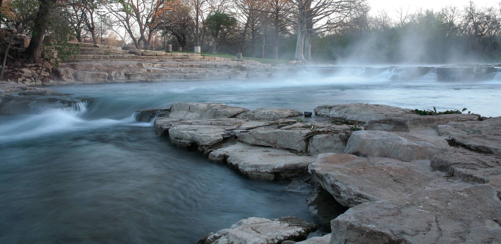
Edwards Aquifer and San Marcos River
Real-Time Levels and Flows
Local Threatened and Endangered Species
All of the forms of life living in the aquifer (groundwater system) have adapted to this existence by being colorless and eyeless. They often have other senses highly developed. All evidence to date indicates that the subterranean aquatic ecosystem of the aquifer is the most diverse groundwater ecosystem known in the entire world.
-
Texas Blind Salamander
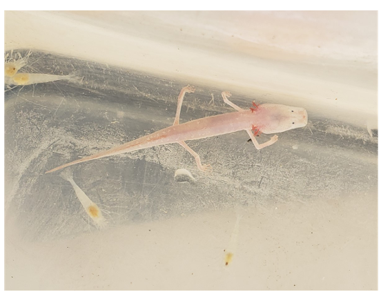
The Texas Blind Salamander, Typhlomolge rathbuni is the top carnivore in the Hays County area of the San Antonio segment of the Balcones Fault Zone Edwards Aquifer. Listed by both the State of Texas and the Federal government as endangered.
-
San Marcos Salamander
The San Marcos Salamander, Eurycea nana is found only in the spring run of San Marcos Springs. Listed by both the State of Texas and the Federal government as threatened.
-
Fountain Darter
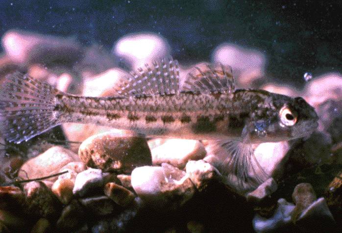
The Fountain Darter, Etheostoma fonticola is found in the spring runs of Comal and San Marcos Springs. These springs flow from the aquifer and will dry if the aquifer levels are not maintained above the lips of the springs. Listed by both the State of Texas and the Federal government as endangered.
-
Texas Wild Rice
Texas Wildrice (Zizania texana) is found in the spring run of San Marcos Springs. Listed by both the State of Texas and the Federal government as endangered.
-
San Marcos Gambusia
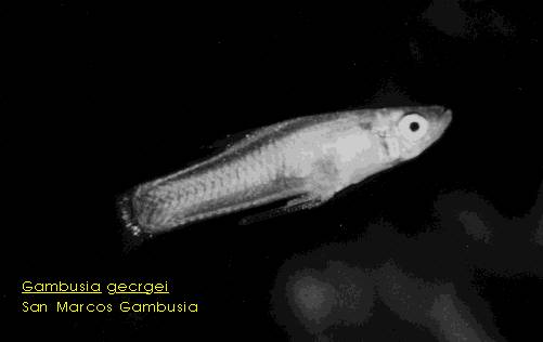
The San Marcos Gambusia, Gambusia georgei has been found in the springrun of the San Marcos Springs. Listed by both the State of Texas and the Federal government as extinct.
-
Blanco Blind Salamander
The Blanco Blind Salamander, Typhlomolge robusta is found in the portion of the Edwards Aquifer north and east of the Blanco River. It closely resembles the Texas Blind Salamander, but has a more robust body with shorter, stouter legs. Listed by the State of Texas as endangered.
-
Comal Blind Salamander
The Comal Blind Salamander, Eurycea tridentifera is found only in the subterranean waters of several caves located within the Cibolo Creek flood plain in Comal and Bexar Counties. Resembles the Texas Blind Salamander, but has shorter legs and the snout is not as flattened. Eyes are buried beneath the skin. Listed by the State of Texas as threatened.
-
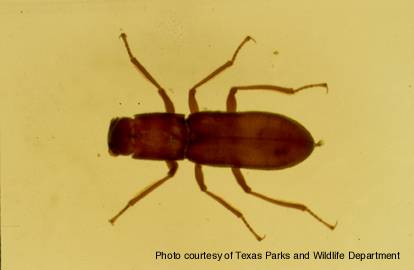
Comal Springs Riffle Beetle
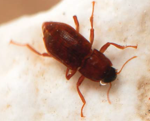
Photo courtesy of Jean Krejca The Comal Springs Riffle Beetle, Heterelmis comalensis (larva at top, adult at bottom), is found in the gravel substrate in the surface waters of Comal Springs (Comal County) and San Marcos Springs (Hays County). Listed by the Federal government as endangered.
-
Comal Springs Dryopid Beetle
The Comal Springs Dryopid Beetle, Stygoparnus comalensisis the first subterranean aquatic dryopid beetle to be discovered. This beetle is eyeless and very weakly-pigmented. It inhabits the water of the Edwards Aquifer. Specimens have been collected from Comal Springs in Comal county and Fern Bank Spring located in Hays county. It may be confined to small areas around these springs, as no specimens have been collected from other locations in the aquifer. Listed as endangered by the Federal government.
-
Peck's Cave Amphipod
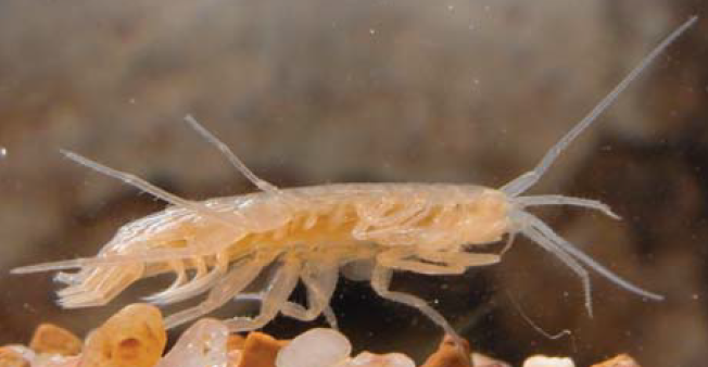
Photo courtesy of Jean Krejca Peck's Cave Amphipod, Stygobromus pecki is a subterranean aquatic crustacean that inhabits the waters of the Edwards Aquifer. It has only been collected at Comal Springs and Hueco Springs ( about 4 miles north of Comal Springs) in Comal county. It may be confined to small areas around these springs, as no specimens have been collected from other locations in the aquifer. Listed by both the State of Texas and the Federal government as endangered.
-
Austin Blind Salamander
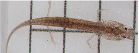
Photo courtesy of Tom Devitt The Austin Blind Salamander, Eurycea waterlooensis is an endangered species which is endemic to Barton Springs area.
-
Barton Springs Salamander
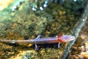
Photo courtesy of USFWS The Barton Springs Salamander, Eurycea sosorum is found among the rubble in the spring outflow of Barton Springs in Austin (Travis County). Listed by the Federal government as endangered.
-
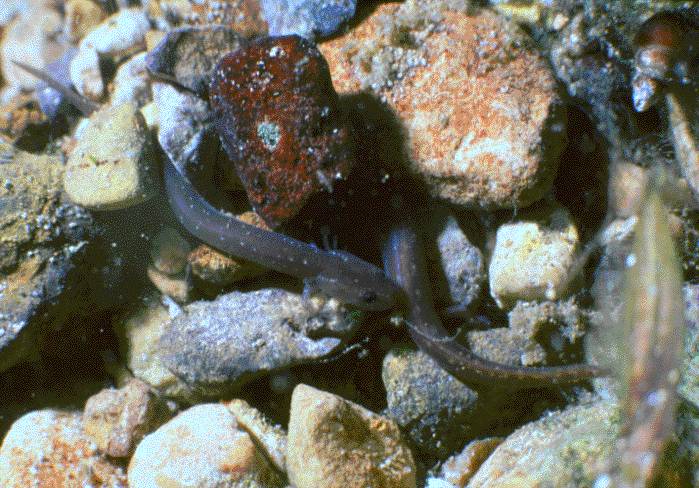
Toothless Blindcat & Widemouth Blindcat
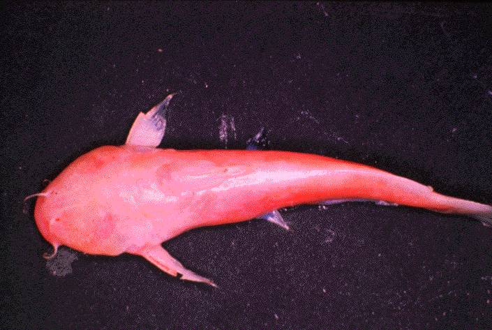
The Toothless Blindcat, Trogloglanis pattersoni is found only in the Bexar Co. area of the San Antonio section of the aquifer. It is found in wells from 1350 feet deep to 2,000 feet deep. It is listed by the State of Texas as threatened.
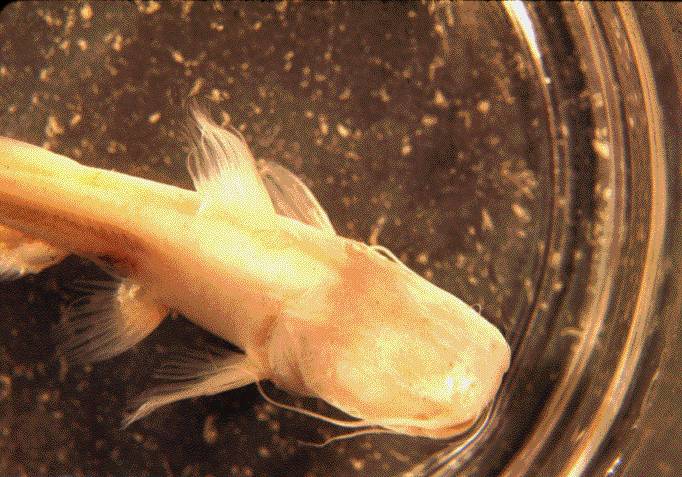
The Widemouth Blindcat, Satan eurystomus is found only in the San Antonio section of the Aquifer, under Bexar County. It is found in wells from 1350 feet deep to 2,000 feet deep. It is the top carnivore in this section of the aquifer ecosystem. It is listed by the State of Texas as threatened.
-
Cascade Caverns Salamander
The Cascade Caverns Salamander, Eurycea latitans is found only in the subterranean waters of Cascade Caverns (Kendall County, Texas). It is pale, with somewhat darker coloration on the upper body. Eyes are buried beneath the skin. Listed by the State of Texas as threatened.
-
USFWS Endangered Endangered and Texas Parks & Wildlife Endangered Species Links: